Skip to content
  • ABOUT PPO
    • Your Regional Partner
    • Mission Vision Values
    • PPO Staff
    • Boards & Councils
    • Colorado Regional Partnerships
    • Supporters
  • Regional Plan
    • Planning Process
    • Published Plan
    • Plan Projects & Strategies
    • Ring The Peak
  • Resources
    • DataHub
    • Reports
    • Outdoor Ethics
    • Business Startup Toolkit
    • Conservation
    • Fire Information
  • News
    • Blog
    • Newsletter
    • Ride Center Project
    • Annual Reports
    • Suggested Reading
  • Get Involved
    • Follow
    • Attend Events
    • Support
    • Volunteer
    • Join Meetups & Clubs
  • GIVE

  • Explore
    Biking
    Climbing
    Fishing
    Hiking
    Horseback Riding
    Hunting / Shooting
    Off-roading
    Snow
    Water Activities
    EXPLORE MORE
    Download a Guide
  • Kids & Family
  • Experiences
  • Adaptive Recreation
  • Waypoints
  • Maps & Apps
  • Events
  • Trip Planning
    • Camping/Lodging
    • "Easy Button" Itineraries
    • Pikes Peak Region Visitors
    • Royal Gorge Region Visitors
    • Fly COS - Airport
    • Visit Cripple Creek
    Gear and Service Providers
  • Find a Group

Your voice for the outdoors

Ring thePeak

A roughly 63-mile loop around America’s Mountain. Close the gaps. Connect the towns. Steward the corridor as one shared landscape.

Support the effort → Designate your gift for Ring the Peak
  1. 01

    The route

    Complete the ring

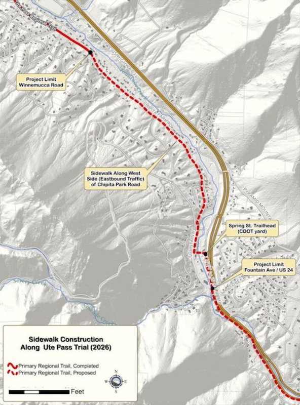
    Close the remaining gaps — especially along Ute Pass and on the southwest flank — so the loop is whole, signed, and usable end to end.

  2. 02

    The towns

    Connect communities

    Portals in Manitou Springs, Cascade, Green Mountain Falls, Teller County, and the high country turn a mountain circuit into everyday access.

  3. 03

    The care

    Steward the corridor

    The trail crosses federal, state, county, city, and private land. Finishing it means coordinated management, not a patchwork of rules.

Explore the route

Open a segment or a trailhead. Tilt the view to see the mountain.

Open full map →

The dashed olive line on the southwest side follows roads you can use. It is not a finished trail. Conditions change—confirm access, seasonal closures, and allowed uses before you go.

Help finish the ring

  • Planning and partnerships that close remaining gaps
  • Trail improvements, portals, and clearer public access
  • Shared stewardship across the agencies that manage the peak

How to give

Gifts to Pikes Peak Outdoors can be designated for Ring the Peak, or given as unrestricted support for the regional outdoor effort.

Support the effort →

THE CASE, IN PLAIN LANGUAGE

Why the ring is still worth finishing

For the region

Most of the circle is already a trail. Finishing it is what makes the rest a destination: one way around America’s Mountain that treats Manitou Springs, the Ute Pass towns, Woodland Park, Cripple Creek, and Victor as places to start, stay, and spend. The 2019 plan is plain about this. The Ring is access, watershed protection, and an economic strategy for the towns on the southwest side.

Since 1999

The ask is older than the Master Plan. In 1997 Colorado Springs Utilities put the agencies in one room. In 1999 they adopted a Perimeter Loop around the peak, and Friends of the Peak spent the next two decades building it. In 2017 the stakeholders reread that plan and agreed the vision still held. The state later named it one of Colorado’s 16. The community has wanted this trail for more than twenty-five years.

To finish it

Build the southwest gap, from Pancake Rocks north of Gillett to Forest Road 376 at the South Slope watershed, without cutting bighorn habitat or closed watershed land. Then do the work the plan would not separate from the dirt: one agreement among the land managers, volunteers trained to maintain what gets built, and funding that outlasts a single grant. The miles, the management, and the public have to close together.

Who has been at the table

Agencies, cities, land trusts, and community groups named in the 2019 Master Plan. The trail only works if they stay in the same conversation.

  • Friends of the PeakCommunity voice
  • Colorado Springs ParksParks, Recreation & Cultural Services
  • Great Outdoors ColoradoPlanning grant
  • City of Cripple CreekGateway city
  • City of VictorGateway city
  • Teller CountyCounty partner
  • El Paso CountyCounty partner
  • City of Woodland ParkUte Pass community
  • City of Manitou SpringsUte Pass community
  • Colorado Parks and WildlifeState land manager
  • U.S. Forest ServicePike–San Isabel
  • Bureau of Land ManagementFederal land manager
  • Colorado Springs UtilitiesWatershed land manager

  • State of ColoradoState partner
  • NewmontCripple Creek & Victor mine
  • Palmer Land ConservancyLand trust
  • Pikes Peak — America’s MountainCity enterprise

  • Pikes Peak OutdoorsNamed in the plan as PPORA
  • Rocky Mountain Field InstituteStewardship partner
  • Trails and Open Space CoalitionProject lead
  • Southern Teller County Focus GroupLocal civic partner
  • El Pomar FoundationHeritage Series

LATEST UPDATES

Ring the Peak Gets Closer: New Portal Opens the Door to a Full Loop Around Pikes Peak
  • September 28, 2026
Read More
Pinestone Ranch: A New Anchor for the Ring
  • September 4, 2026
Read More
Ring the Peak Makes the National Short List: A Major Step for Long-Distance Trails on America’s Mountain
  • August 26, 2026
Read More
Previous Page1 Page2 Page3 Next
Explore
  • Activities
  • Outdoor Events
  • Gear & Services
  • Places
  • Trails
  • Family Adventure Guide
  • Trip Planning
Resources
  • Blog
  • Hiking Bob Podcast
  • Fire Information
  • Outdoor Ethics
  • Maps & Apps
  • Helpful Links
  • Gear & Services​
  • Licenses
  • Downloadable Guides
Get Involved
  • Follow
  • Support
  • Volunteer
  • PPO Events
  • Contact Us
Regional Partner
  • About Us
  • Regional Vision Plan
  • Annual Reports
©2026 Pikes Peak Outdoors. All Rights Reserved.
  • Privacy Policy
  • Website Accessibility Policy
  • XML Sitemap
  • HTML Sitemap
  • Explore
  • Kids & Family
  • Experiences
  • Adaptive Recreation
  • Waypoints
  • Maps & Apps
  • Events
  • Trip Planning
    • Camping / Lodging
    • “Easy Button” Itineraries
    • Pikes Peak Region Visitors
    • Royal Gorge Region Visitors
    • Fly COS – Airport
  • Find a Group
  • Explore
  • Kids & Family
  • Experiences
  • Adaptive Recreation
  • Waypoints
  • Maps & Apps
  • Events
  • Trip Planning
    • Camping / Lodging
    • “Easy Button” Itineraries
    • Pikes Peak Region Visitors
    • Royal Gorge Region Visitors
    • Fly COS – Airport
  • Find a Group
  • ABOUT PPO
    • Your Regional Partner
    • Mission Vision Values
    • PPO Staff
    • Boards & Councils
    • Colorado Regional Partnerships
    • Supporters
  • Regional Plan
    • Planning Process
    • Published Plan
    • Plan Projects & Strategies
    • Ring The Peak
  • Resources
    • DataHub
    • Reports
    • Outdoor Ethics
    • Business Startup Toolkit
    • Conservation
    • Fire Information
  • News
    • Blog
    • Newsletter
    • Ride Center Project
    • Annual Reports
    • Suggested Reading
  • Get Involved
    • Follow
    • Attend Events
    • Support
    • Volunteer
    • Join Meetups & Clubs
  • GIVE
Biking
Climbing
Fishing
Hiking
Horseback Riding
Hunting / Shooting
Off-roading
Snow
Water Activities
Explore More